The Geospatial Computing and Society Lab studies how geospatial technologies are designed, deployed, and governed, with a focus on their social consequences and possibilities for more just futures. Our research spans spatial data science, geospatial artificial intelligence, and critical GIS, and pursues two interconnected directions: (1) developing computational and AI methods that explicitly account for issues such as location privacy and spatial inequalities across data systems, algorithmic models, and policy contexts; and (2) critically examining the social, political, and ethical implications of emerging geospatial technologies (e.g., GeoAI) and envisioning alternative ways these systems can be designed, governed, and used.
We’re looking for prospective graduate and undergraduate students interested in the intersections of spatial data science, GeoAI, spatial and social inequalities, and critical GIS. Prospective students are encouraged to email me at linyue@illinois.edu with their CV. Prospective graduate students should also review the GGIS Graduate Programs application page.
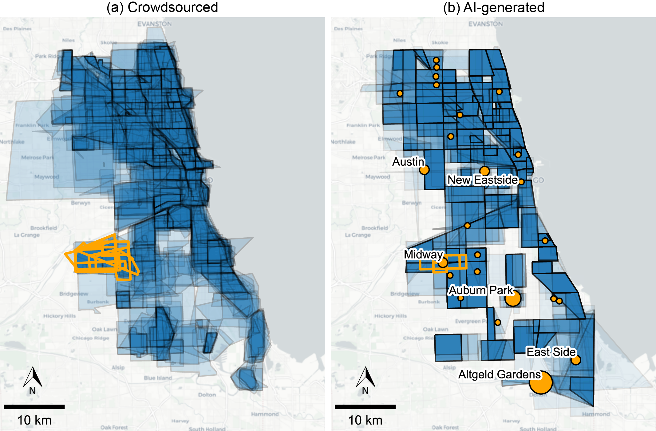
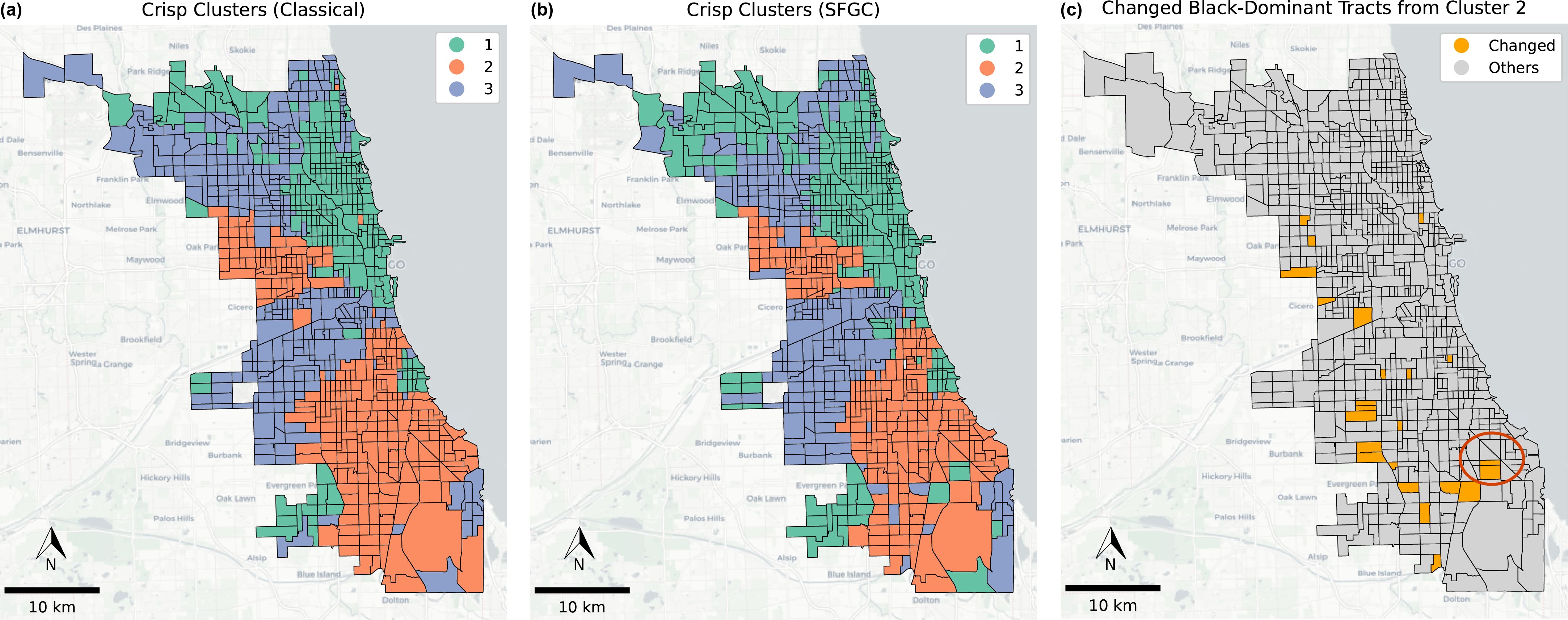
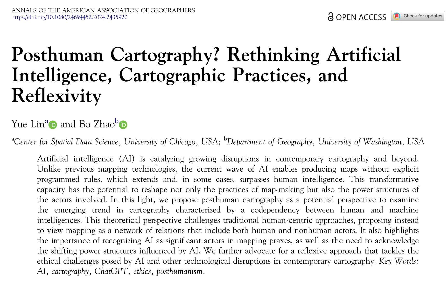
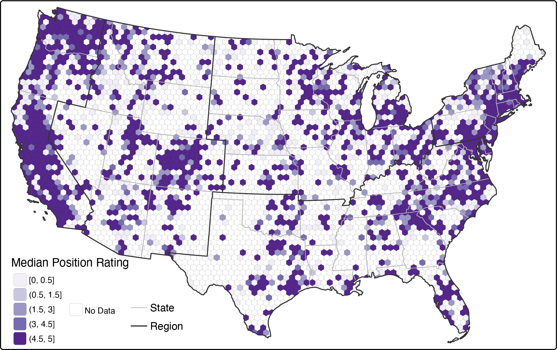
Recent Projects
Current Members

Angela Li
Angela is a senior undergraduate student majoring in Geography with a concentration in GIS. Her research interests lie at the intersection of human-environment interactions and social relations. She is working with Dr. Lin on her senior thesis, which focuses on Neighborhood-Scale ESG Assessment of Urban Environments Using Street View Imagery in Chicago.

Emma Chen
Emma is a rising senior at UIUC studying statistics with minors in data science and creative writing. She is working with Dr. Yue Lin through the Summer 2026 SPIN internship.
Past Members
Janice Mei, Oviya Muthukumaran, Ashlynn Wimer, Qian Fang Yeap, Enrico Madani, Na Nguyen, Marcus Kuo, Yassir Atlas, Helen Michael